|
|
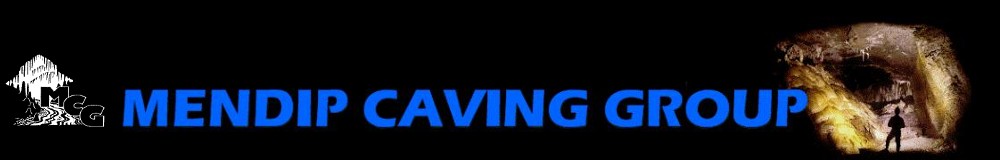
Upper Flood Swallet surveys
Upper Flood Swallet survey at September 2016 (pdf version)
 |
Click image or here to see the latest Upper Flood Swallet survey (courtesy of Ben Cooper)
This work is licensed under the Creative Commons Attribution-Non-Commercial-Share Alike 2.0 UK: England & Wales License. Copyright 2016 Mendip Caving Group.
To view a copy of this licence, visit http://creativecommons.org/licenses/by-nc-sa/2.0/uk/
Copies of the 2016 survey have been made available as a SplashMap. Please get in touch with the club if you would like to buy one.
|
Upper Flood Swallet in relation to the surface
 |
Click image or here to see an overlay of Upper Flood Swallet and other caves of the Blackmoor valley in relation to the surface (survey courtesy of Ben Cooper, Google maps courtesy of Bill Chadwick). Normal left mouse drag to pan, double left click to zoom in, double right click to zoom out or mousewheel zoom. Press the round blue ? button for help.
|
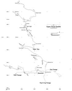
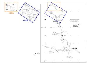
Other surveys (click to enlarge)
|
1976 area plan
 |
1976 cave survey
 |
|
1996 cave survey
 |
2007 cave survey
 |
|
Progress 1968 to 2007
 |
|
|
|
Mendip Caving Group. UK Charity Number 270088. The object of the Group is, for the benefit of the public, the furtherance of all aspects of the exploration, scientific study and conservation of caves and related features. Membership shall be open to anyone over the age of 18 years with an interest in the objects of the Group.
|